One of the research sites of the EENSAT project is Zamra catchment (Figure 1). It is one of the most upstream contributing catchment to Tekeze River Basin. All three PhD students from Mekelle University carry out their research activity at Zamra catchment. As part of the Research component, EENSAT has installed several field equipment at Zamra Catchment including weather station, groundwater observation, irrigation scheme observation, stream gauging, and water quality observation. Local partners including Tigray Bureau of Water Resource, Tigray Meteorological Agency, Tigray Bureau of Agriculture and Rural Development and local administration are consulted prior to field equipment installation to ensure their sustainability.
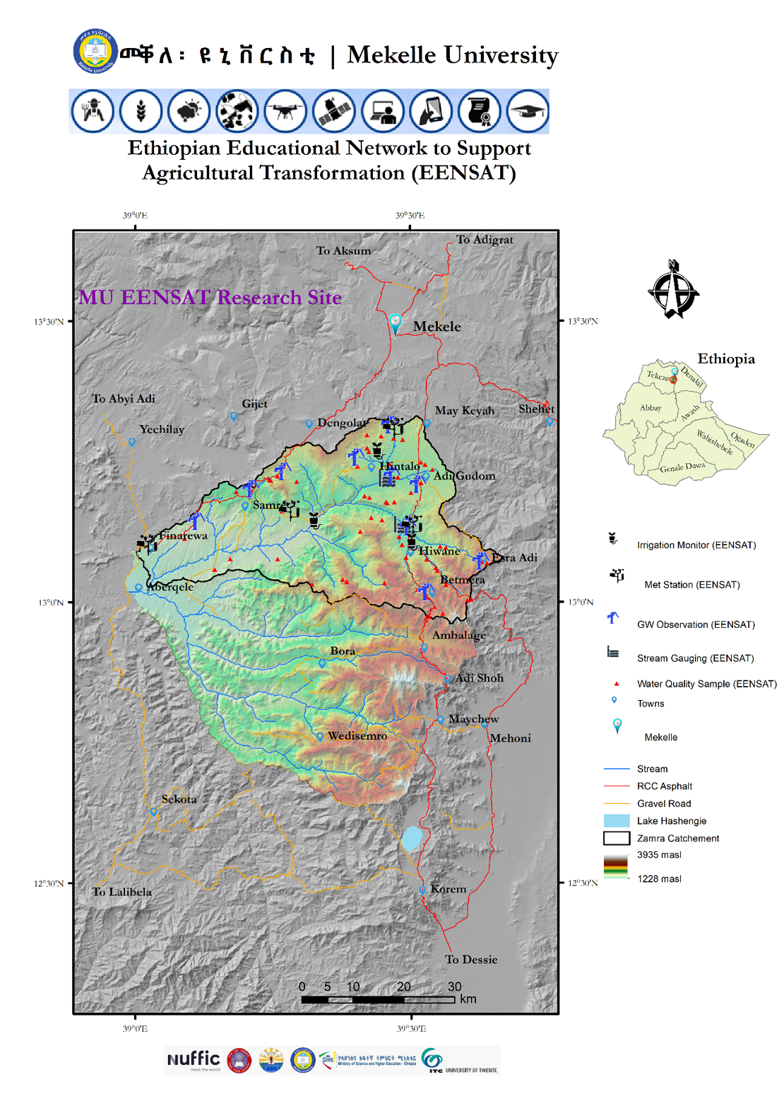
Figure 1: Location of MU-EENSAT Research Site
Selection of an observation site is not an easy task; it needs an intensive field verification and accordingly each of the field monitoring sites were selected after each PhD student conducted an intensive field campaign, with immediate supervision from their local supervisors and promoters from ITC (Figure 2). During the first field verification with local promoters, field visit took 9 hr continuous walk from the most upstream part to the mid-section of Zamra catchment!
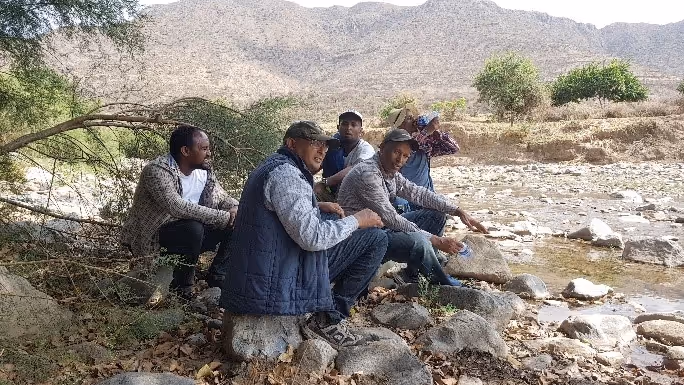
Figure 2: Field campaigns for selection and verification of field monitoring sites (both pictures)
Installed equipment
Automatic Weather Stations
In order to support the research of the PhD students, 4 automatic weather stations with 12 parameters, and one automatic weather station with 4 parameters is installed across Zamra catchment. The type of automatic weather station installed at Zamra is Atmos-41 sensor (Figure 3). In order to protect from vandalism, 4 of the automatic weather stations with 11 channels are installed in the periphery of local Farmers’ Training Center (FTC) or at health posts and all are fenced with mesh wire to protect from vandalism. One of the automatic weather station with 4 channels is installed at a periphery of farmer’s plot. The weather stations with 12 parameters have soil moisture sensors that can record soil moisture profiles at 4 depths. Tigray National Meteorological Office supported the installation of these equipment.
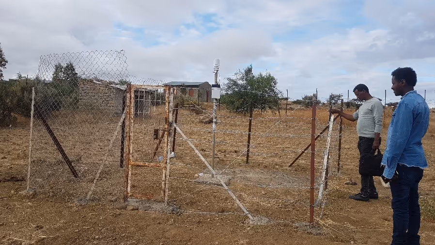
Figure 3: Automatic weather station and soil moisture sensor
Groundwater Observation
In order to evaluate water resource potential of the groundwater and its interaction with surface water, 9 groundwater observation wells are installed. The observation wells are from confined and unconfined aquifer that are not functional at the moment because of mechanical failures of pumps. All the sensors are Keller DCX-22 Level Logger type and the observation wells are well protected (Figure 4). Tigray Bureau of Water Resources and local administration provide unreserved support on the provision of the observation wells.
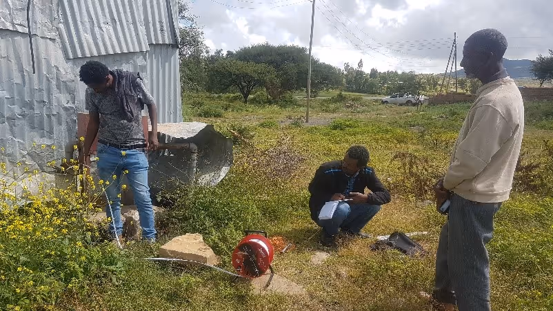
Figure 4: Groundwater observation
Irrigation Scheme Monitoring
Water management at irrigation field is one of the research interest of EENSAT project. Accordingly, there are 4 soil moisture sensors installed at Zamra at micro-dam sites and river diversion sites (Figure 5). These sensors record soil moisture at 4 depths of soil profile. The soil moisture sensors are EM50 data loggers designed for use with any ECH2O sensor.
|
|
|
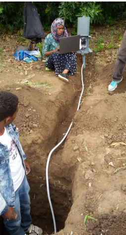
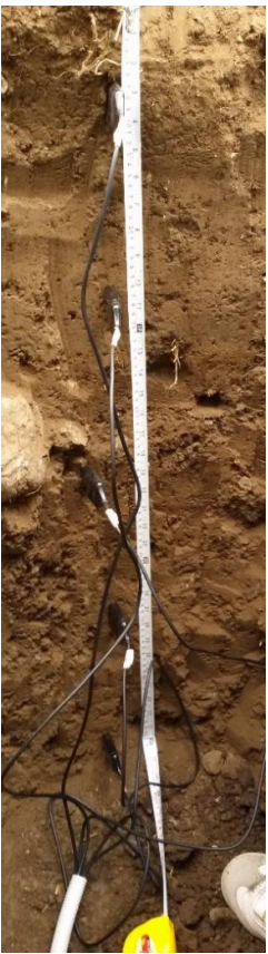

Figure 5: Soil moisture sensors at irrigation site
Stream Gauging
One of the main research component of EENSAT project at Zamra is surface water; modeling surface runoff magnitude and its interaction with groundwater. Accordingly, two stream gauging stations are established at Zamra (Figure 6a). The two gauging sites are established in close collaboration with Tigray Bureau of Water Resource and local administrations. Both the sensors are Keller DCX-22 Level Logger type and the sensors are buried below the stream bed with metallic protection caps. Topographic survey was conducted using total station to establish the cross sectional and longitudinal profile at the gauging site (Figure 6b) .
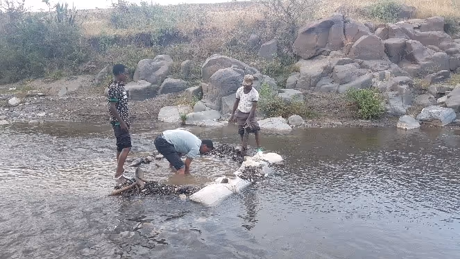
Figure 6a: Stream gauging using automatic gauges
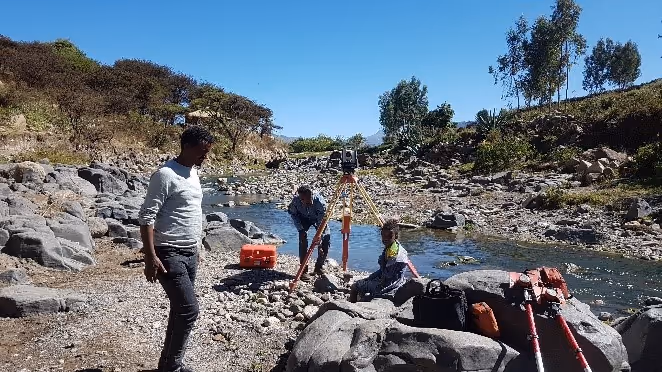
Figure 6b: Stream gauging using topographic surveying at stream gauging site using total station
Water Quality Monitoring
As part of EENSAT capacity building through research, an ITC MSc student was attached with Tigray Bureau of Water Resources to conduct water quality assessment at Zamra. Accordingly, 60 water samples are collected across surface and groundwater at Zamra (Figure 7). Water quality was analyzed at the ITC laboratory for physico-chemical analysis.
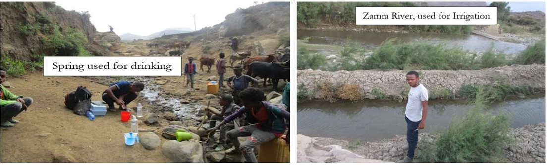
Figure 7: Water quality analysis
More recent news
 Tue 18 May 2021Training of trainers of TVET and Development Agents by BDU continues
 Tue 27 Apr 2021Successful Training of Trainer approach implemented at Bahir Dar TVET
 Thu 15 Apr 2021Tigray Bureau of Water Resources and Tigray Bureau of Health trained
 Thu 1 Apr 2021Development Agents trained at BDU on GIS for Natural Resource Management
 Thu 18 Mar 2021EENSAT features at MoSHE event