EENSAT is an innovative capacity development project to strengthen the use of geo-data for agriculture and water to enhance food security and socio-economic development in Ethiopia in line with the Growth and Transformation Plan (GTP) priorities at the participating Higher Education and Technical Vocational Education and Training (TVET) institutes.
The following outcomes are to be achieved:
- A coordinated and harmonized system is established where network partners cooperate and support each other, that provides gender-sensitive and appropriate education in the use of Geo-information Science, that is responsive to the GTP objectives at academic and vocational training levels;
- An active, collaborative and coherent Geo-Information based research programme between network partners in line with the needs of stakeholders in the public and private sector, and contributing to the GTP objectives;
- Demand driven outreach activities are taking place to ensure sustainable collaboration between the network, the public and private sector that determines the research and education profiles, stimulates spin-off and entrepreneurship, and expands to engage other stakeholders.
Background
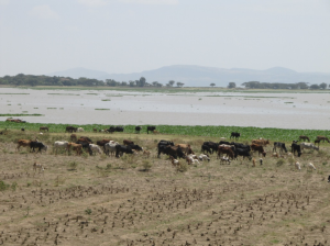
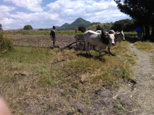 Ethiopia strives to become a middle income country and in order to achieve this it must realize steep growth in manufacturing and export. The Growth and Transformation Plan (GTP) identifies the agricultural sector as playing a leading role in the growth of the Ethiopian economy. The government objectives are to modernize agriculture and improve its efficiency and productivity, ensure food security, create employment opportunities and enhance the country’s foreign exchange earnings with the aim to promote the development of a vibrant industrial sector and accelerate overall economic growth. Achieving the objectives in the GTP will benefit from the use of spatial information and earth observation techniques. For example, food security is threatened by drought, climate-induced hazards and environmental degradation. To meet these challenges, new knowledge and skills are required, the education sector playing a pivotal role as higher education and Technical Vocational Education and Training (TVET) institutes should turn out the right skilled people for a changing job market. The job requirements at government and private sector and the current workforce’s knowledge and skills both at academic and TVET level should be appropriately aligned to meet the demands.
The eensat project
 Discussions have already been ongoing between project partners for a couple of years and resulted in a Letter of Agreement which was signed in April 2016 between University of Twente, Faculty of Geo-information Science and Earth Observation (ITC) and the Ministry of Education of Ethiopia. The proposal developed is based on the requirements put forward by the ministry and the participating universities during these meetings. The main objective of the project is to strengthen and align the capacity of the higher learning centres (University and Technical Vocational Education and Training) in Ethiopia with the requirements as formulated in the Ethiopian Growth and Transformation Plan, with special emphasis on food security, water resources, climate change and land administration. Duration of the project is from 01-01-2017 to 31-12-2020. Total available budget is 2.200.000 Euro, which is provided by the Dutch organisation for internationalisation in education (NUFFIC), University of Twente, ITC and the Ministry of Education of Ethiopia. Project partners are:
- Ethiopian universities:
- Bahir Dar University - Institute of Disaster Risk Management and Food Security / Geospatial Data and Technology Centre
- Addis Ababa University – Africa Centre for Disaster Risk Management
- Mekelle University – Institute of Geo Information and Earth Observation Science
- University of Twente, Faculty ITC
Output
The EENSAT project envisages the following output:

- Curriculum review and updated GI-program and staff trained in new domain specific courses;
- Installation of computer cluster infrastructure together with audio /video recording facilities;
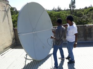
- Utilization of low cost data acquisition systems, like UAVs and satellite reception
stations; - Utilization of low cost, free or open source Geo-Information software tools;
- Review of education management and quality control procedures;
- Coherent applied research-program between 3 Universities supported by PhD and MSc studies;
- Common research area equipped with necessary in-situ data collection systems;
- Linkage between University and selected Technical Vocational Education and Training (TVET) institutes;
- Linkage between network and stakeholders from private and public sector;
- Introduction of digital learning management systems and provision of distance education, also in support of TVET
- Stimulation of entrepreneurship – new product development and other spin-off creation activities;
- Extension of collaboration with other knowledge institutes or networks, both national or within the region;
- Strong emphasis on sustainability to ensure continuity of education, research and outreach activities.